Building date: 1844
Original use: Smokehouse
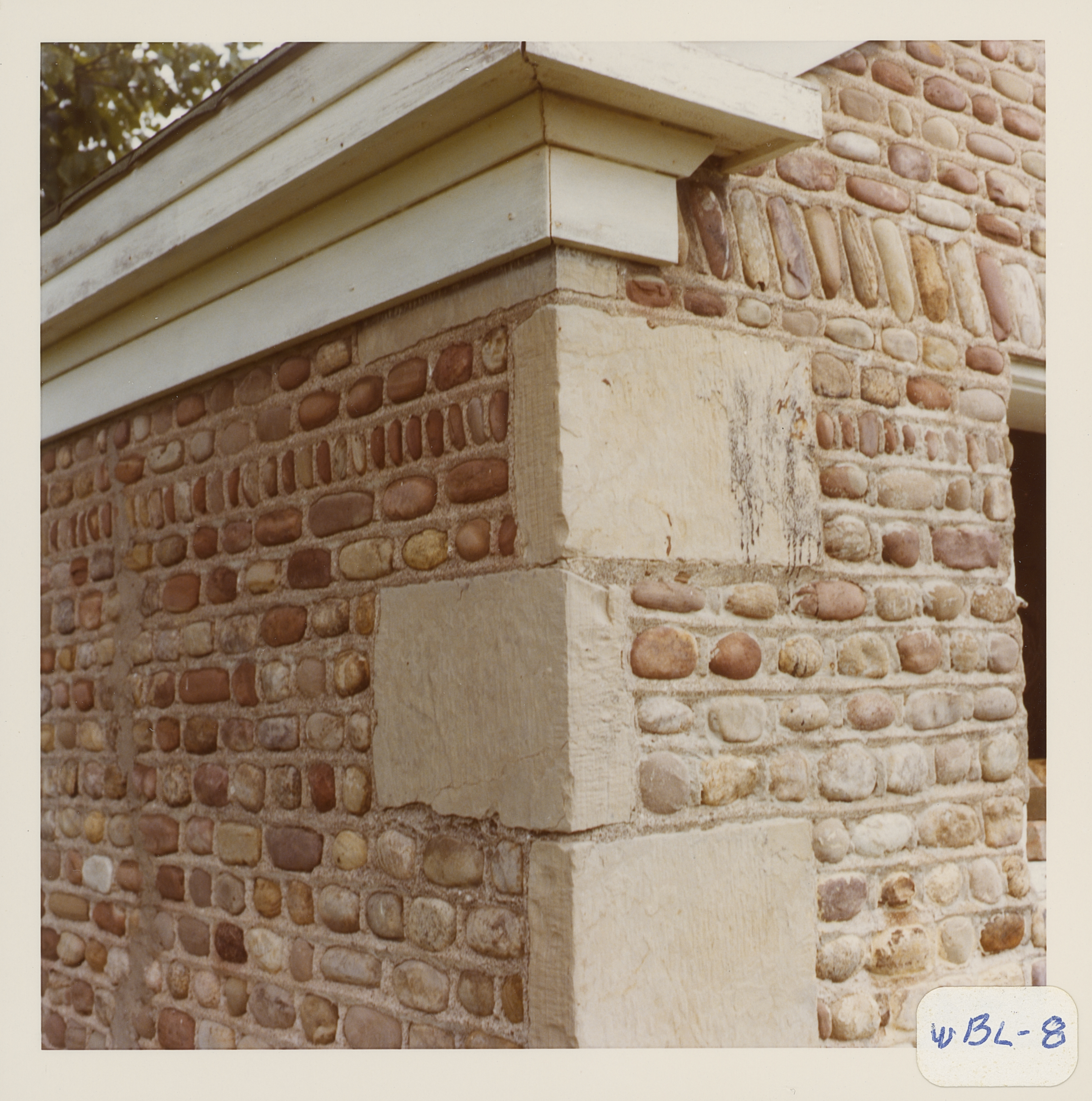
Corner structures: Uniform quoins
Mortar application and content: Vertical heavy. Horizontal and vertical similar (Mortar looks square)
Types and uses of stones: Vertical decorations in small areas. In the front, there are 5 rows of stones per quoin, while there are 4 on the sides. On the sides, there is a row of stones placed vertically near the top. Across the front, just above the door is a row of larger vertical stones slanted slightly from the sides toward the center.
Types and choice of windows:
Structures with similar masonry details:
Masons who worked on building:
Unique features:
Map views courtesy Google Maps. Address is Google Earth confirmed; 42°54'08.34"N 77°29'54.40"W. Current owner of record, Orellana-Clark as of the 2019 Tax Roll.
Town of West Bloomfield and Ontario County Maps
Built in 1844, this smokehouse has uniform quoins. In the front, there are 5 rows of stones per quoin, while there are 4 on the sides. On the sides, there is a row of stones placed vertically near the top. Across the front, just above the door is a row of larger vertical stones slanted slightly from the sides toward the center. Roudabush Survey page 91
Smoke house at 8361 Route 5 and 20 was demolished and stones and date stone were incorporated into a new fireplace at the residence. Date stone says "A.D. 1844." Richard Palmer blog.
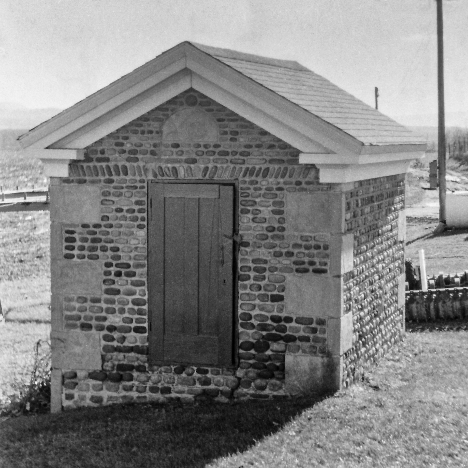 Wbl-8 Powers Smokehouse 1.jpg ¹ 1970 photograph by Clyde Maffin, Ontario County Historian 1968-81. | 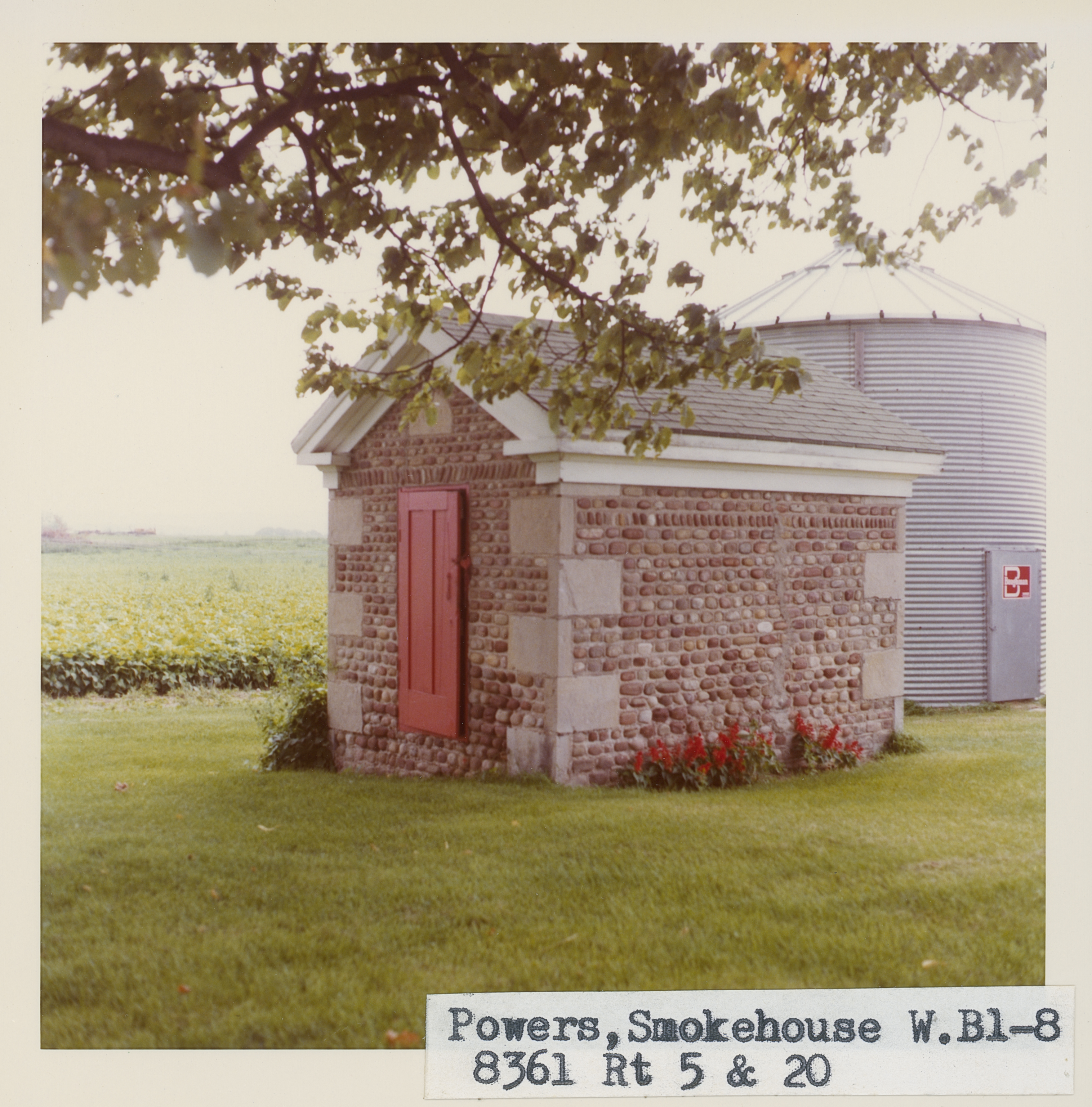 Wbl_8_1.jpg | 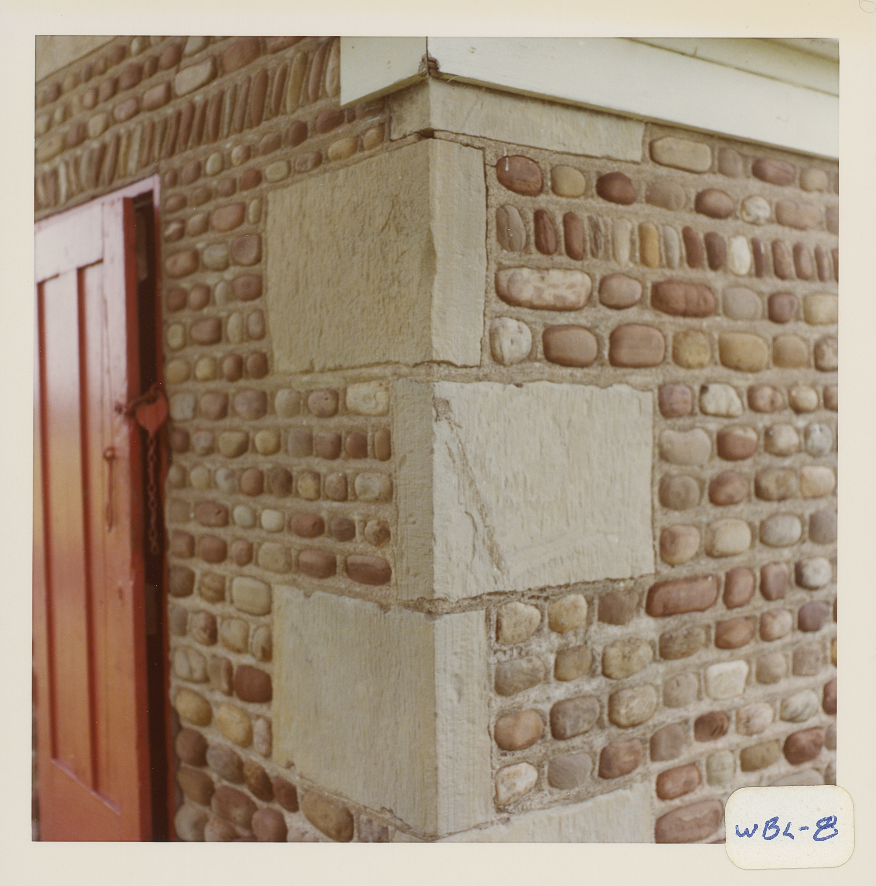 Wbl_8_2.jpg | 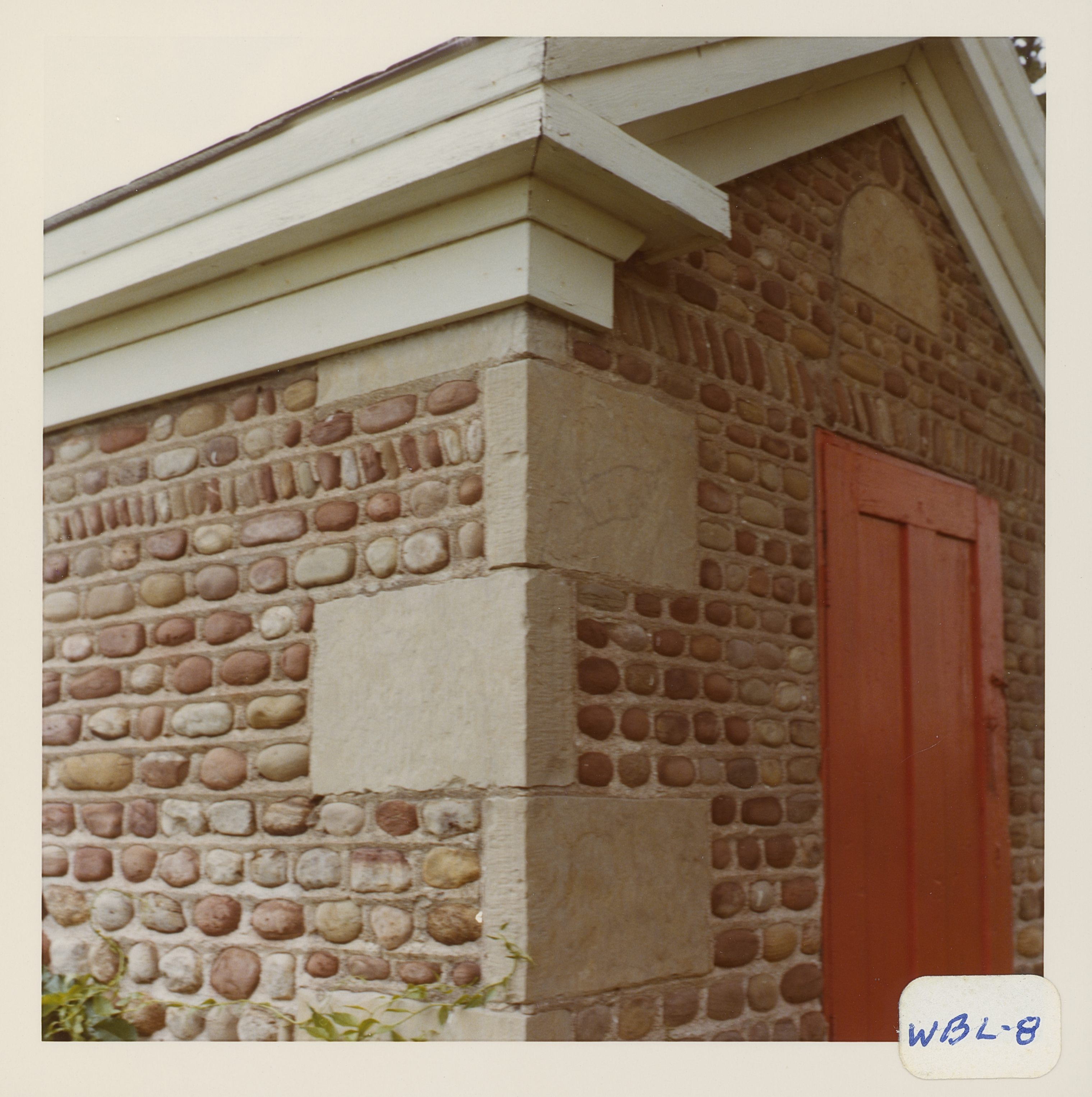 Wbl_8_3.jpg |
 Wbl_8_4.jpg | 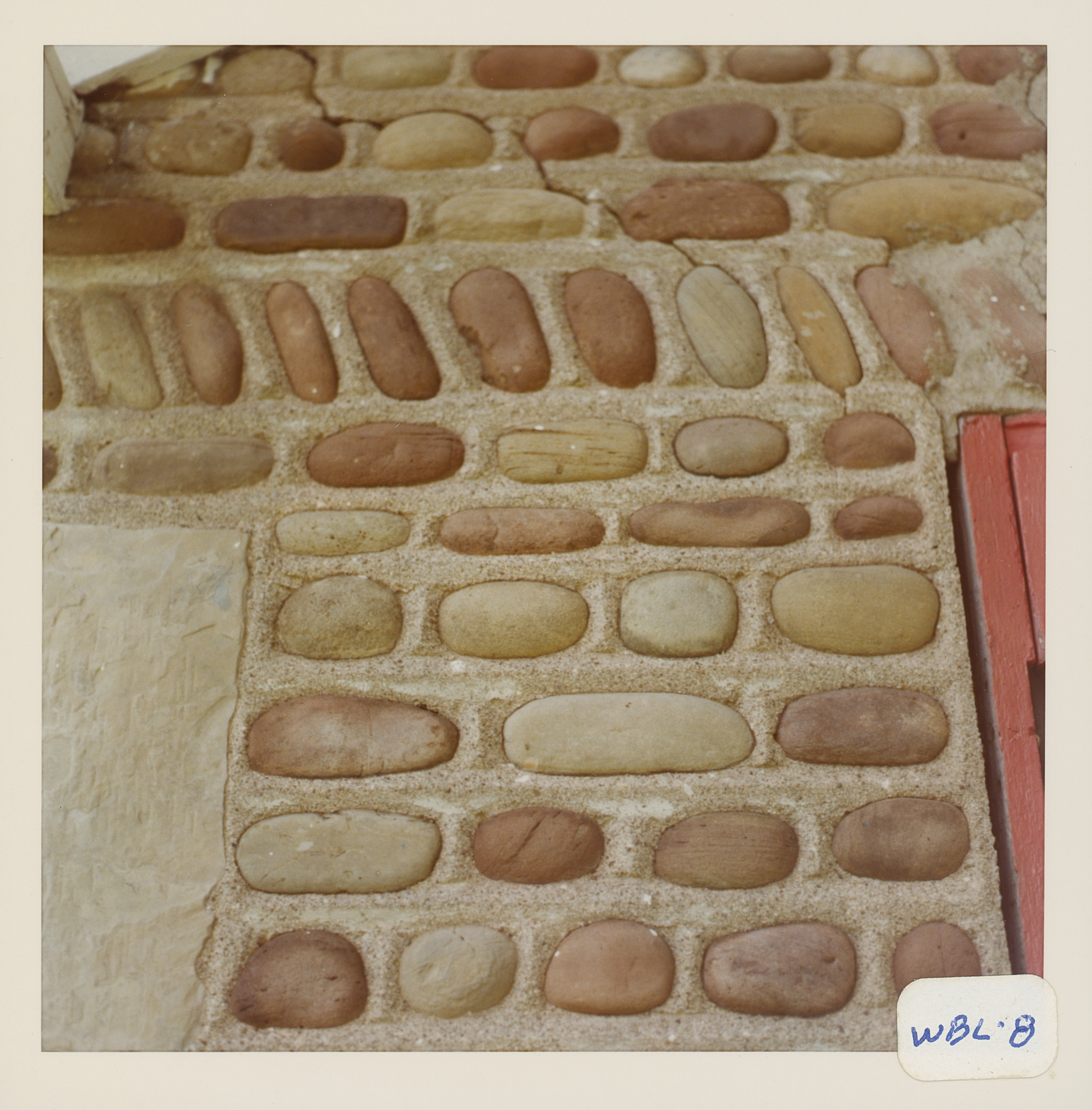 Wbl_8_5.jpg | 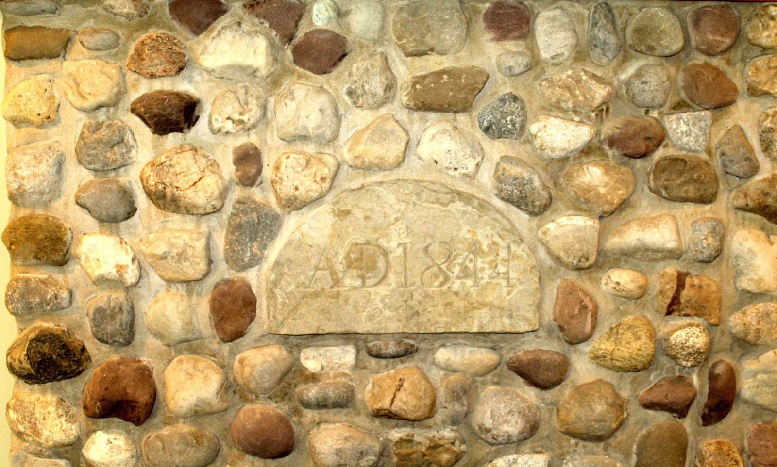 Fire place.jpg ² |
¹ Image courtesy Cobblestone Museum.
² Photography courtesy Richard Palmer.
